Presentation Details
Precise Occupancy Grid Map Generation with only FMCW Radar
ID:1902
View Protection:ATTENDEE
Updated Time:2021-12-14 17:22:21
Hits:272
Poster Presentation
Start Time:2021-12-17 08:25(Asia/Shanghai)
Duration:1min
Session:P2 Poster2021 »
Abstract
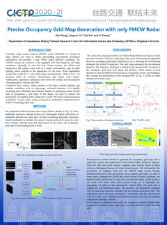
As is more robust compared to LIDAR, visual system, GPS and other proprioceptive sensors, radars operate well to detect objects at a long-range under different weather and lighting condition. The occupancy grid map is suitable for a high-level abstract representation of the environment, which is common in the robotics field. In this paper, we proposed a robust and precise radar-only algorithm of the occupancy grid map. Using the FMCW radar scan as an input, we first extract landmarks from noise measurements with minimal false positives and avoiding the detection of ghost objects. To estimate the radar’s relative motion, we associate with different landmarks corresponding to the same location at different times. With the pose information of radar and radar’s measurement, finally, we generate an occupancy grid map based on the inverse sensor model fit with radar’s characters. We experiment with our method in the Oxford Radar RobotCar Dataset, and the result shows map’s contours are sharp and distinct and our method can work well alone when other sensors drop out. Our grid map is also suitable for self-localization tasks that is precise enough for ego-motion estimation.
Keywords
CICTP
Speaker

Yi Zhang
Tsinghua UniversitySubmission Author
All Comments
Important Date
-
Conference Date
Dec 17
2021
toDec 20
2021
-
Dec 16 2021
Contribution Submission Deadline
-
Dec 24 2021
Registration deadline
Sponsored By
Chinese Overseas Transportation Association
Chang'an University
Chang'an University
Contact Information
- CICTP2020-21 Conference Organizing Committee
- ci******@gmail.com
Previous Conferences
-
2025-07-22 China 广州市(Guangzhou)
第25届COTA国际交通科技年会 -
2024-07-23 China Shenzhen
第24届海外华人交通协会国际交通科技年会(CICTP 2024) -
2023-07-15 China 北京(Beijing)
海外华人交通协会国际交通科技年会 -
2022-07-08 China Changsha
The 22nd COTA International Conference of Transportation Professionals -
2019-07-06 China 南京
The 19th COTA International Conference of Transportation Professionals -
2018-07-05 China Haidian District
18th COTA International Conference of Transportation Professionals -
2016-07-06 China Shanghai, China
The 16th COTA conference International Conference of Transportation Professionals -
2013-08-14 China 深圳市
International Conference of Transportation Professionals

Submit Comment